
Project Details / 项目资讯
- Company / 公司:

- GitHub URL / GitHub 链接: Morphological-Building-Index
Description / 描述
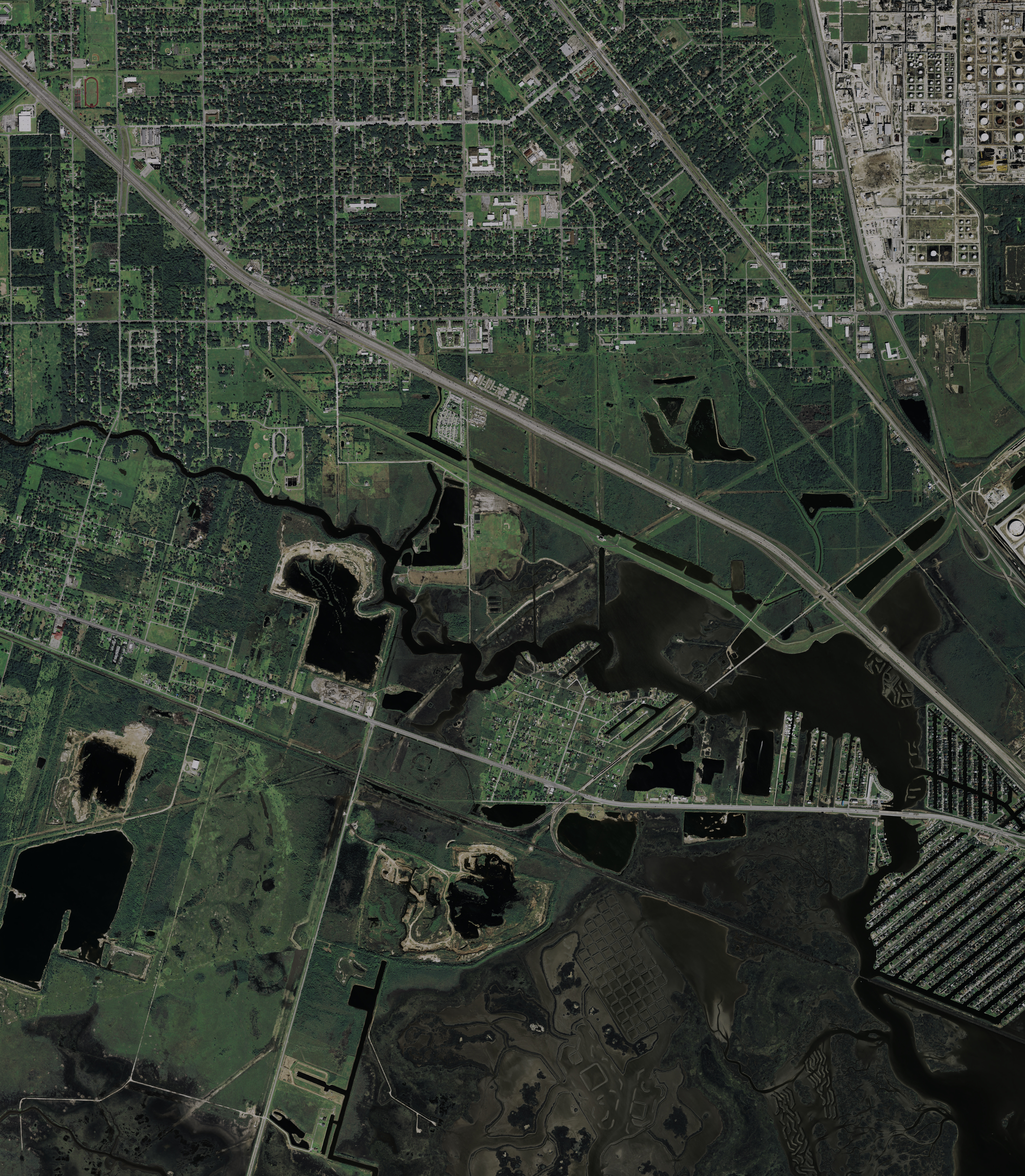
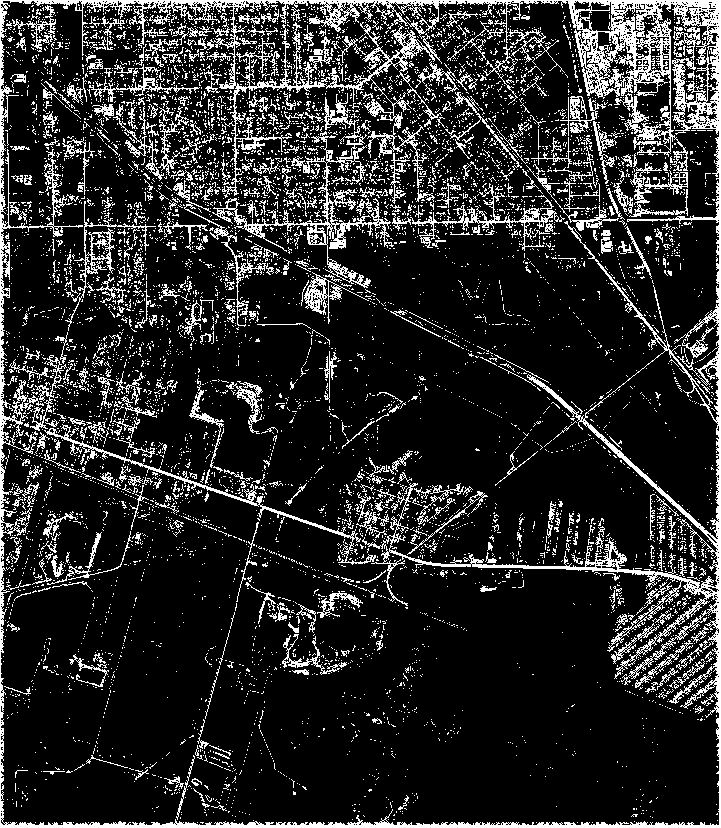
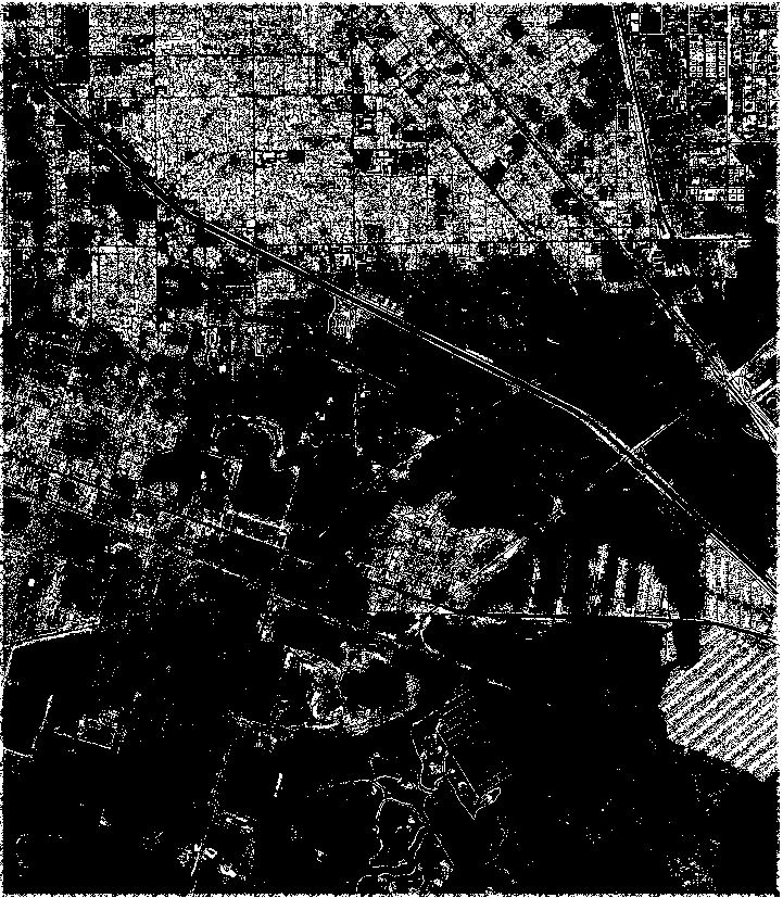
The Morphological Building Index (MBI) is a feature map which is obtained from a sequence of morphological operations on a gray-scale intensity image derived from the original RGB remote sensing image, and is intended to extract buildings from remote sensing images. Meanwhile, the Morphological Shadow Index (MSI) is a complimentary feature map, which is computed in a similar manner to the MBI, and used to extract the shadows accompanying buildings in order to reduce the number of false positives. These 2 indices are supposed to be used together in an object-based framework to maintain high accuracy of building extraction while reducing the false positive rates as well. The three images are the original remote sensing image, the thresholded MBI feature map, and the thresholded MSI feature map (from left to right respectively).
形态学建筑指数(MBI)是从原始 RGB 遥感图像得到的灰度强度图像上进行一系列形态学操作获得的特征图,从而提取图像上的建筑物。 形态学阴影指数(MSI)是一个互补的特征图,其计算方式与 MBI 相似,用于提取伴随建筑物的阴影,从而减少错误侦测的数量。 这两个指数都应该在基于对象的框架中一起使用,旨在减少错误侦测的同时,保持建筑物提取的高准确性。 这三张图像分别是原始的遥感图像、经过阈值处理的 MBI 特征图以及经过阈值处理的 MSI 特征图(从左到右)。
Reference
[1] X. Huang and L. Zhang, "Morphological Building/Shadow Index for Building Extraction From High-Resolution Imagery Over Urban Areas," in IEEE Journal of Selected Topics in Applied Earth Observations and Remote Sensing, vol. 5, no. 1, pp. 161-172, Feb. 2012, doi: 10.1109/JSTARS.2011.2168195.