
Project Details / 项目资讯
- GitHub URL / GitHub 链接: Multi-Scale-Filtering-Building-Index
Description / 描述
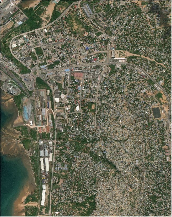
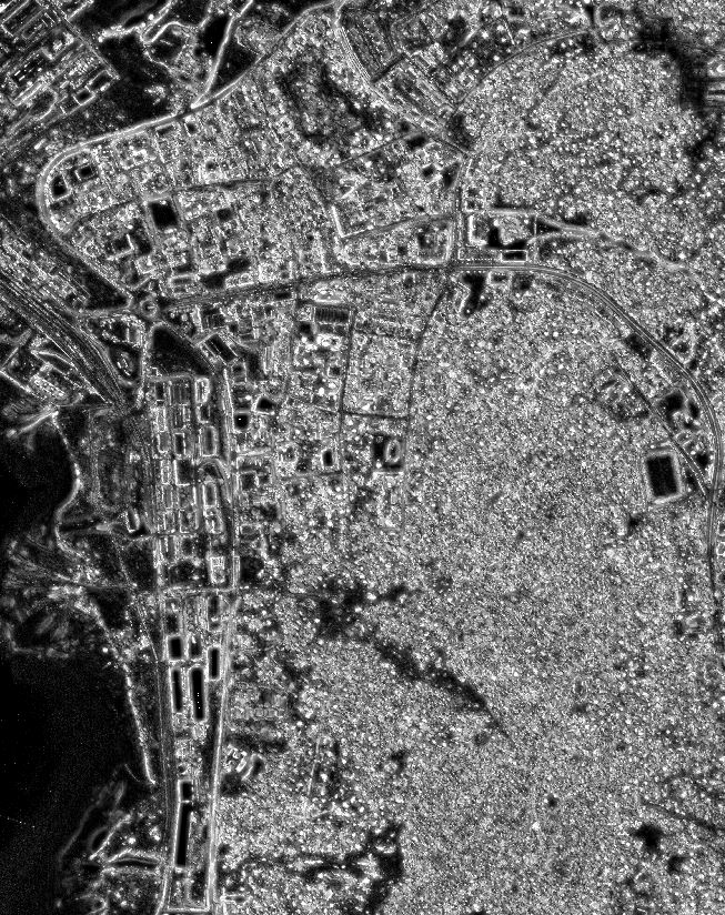
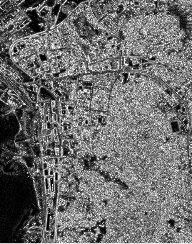
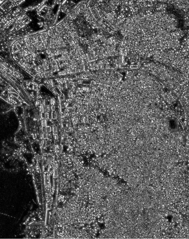
The Multi-Scale Filtering Building Index (MFBI) is intended as an upgrade over the Morphological Building Index (MBI), and also to deal with increasing levels of noise in very high resolution remote sensing images for the semantic segmenation of buildings from remote sensing images. In addition, two variants of the MFBI are also proposed to better utilize the relatively limited spectral information in very high resolution remote sensing images, which are called Multi-Channel Multi-Scale Filtering Building Index (MMFBI). The difference between these two variants is that one utilizes Principal Component Analysis (PCA) on the raw remote sensing image (called version 1), while the other utilizes PCA on the obtained MFBI feature maps which are computed from the raw remote sensing images (called version 2). The four images shown on this page are the original remote sensing image, the MFBI image, the MMFBI (version 1) image, and the MMFBI (version 2) image. (from left to right respsectively).
多尺度滤波建筑指数(MFBI)是基于形态学建筑指数(MBI)而创的升级版指数,并且又适用于处理超高分辨率遥感图像中与日俱增的噪声来提取建筑物轮廓。 此外,原创者还提议了两种 MFBI 的升级版,以更好地利用超高分辨率遥感图像中相对有限的光谱信息,而这两者均被称为多频道多尺度滤波建筑指数(MMFBI)。 这两个升级版之间的区别在于,一个使用原始遥感图像的主成分分析(PCA)(称为版本 1),而另一个使用从原始遥感图像计算得出的 MFBI 特征图做 PCA(称为版本 2)。 此页面展示的四幅图像分别是原始的遥感图像, MFBI 图像, MMFBI (版本 1) 图像 和 MMFBI (版本 2) 图像(从左到右)。
Reference
[1] Bi, Q., Qin, K., Zhang, H., Zhang, Y., Li, Z., & Xu, K. (2019). A multi-scale filtering building index for building extraction in very high-resolution satellite imagery. Remote Sensing, 11(5), 482.